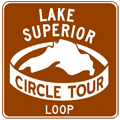
Lake Superior Circle Tour
 As the first "official" routing of the Great Lake Circle Tours,
the approximately 1,300-mile long Lake Superior Circle Tour can trace its
history back to a loosely-organized "circle coute" around the Big Lake
in the 1960s. Promoted by local tourist organizations by way of brochures,
pamphlets and other promotional materials, the earlier incarnations of
a loop route around the largest freshwater lake in the world were not signposted
and travellers had to rely on the tourist brochures to find their way.
In 1985, Michigan First Lady Paula Blanchard, who was an advisor to the Michigan Department of Commerce at the time, pitched the idea to establish a tour route around Lake Superior at a tourism conference that fall. Soon after, the Michigan Department of Transportation drafted a design for the signs and, working with the Wisconsin Department of Transportation (WisDOT), Minnesota Department of Transportation (Mn/DOT) and the Ontario Ministry of Transportation (MTO), helped devise a route around the largest of the Great Lakes. LSCT signs were posted during the summer of 1986.
The Lake Superior Circle Tour is 1,287 miles (2,071 km) long. Even though the direct distance between Ironwood and Sault Ste. Marie, Michigan is less than the direct distance from Sault Ste. Marie to Pigeon River, Ontario, since the LSCT travels the length of the Keweenaw Peninsula as well as looping through the Tahquamenon Falls region, there is actually more route mileage in Michigan (40%) than in Ontario (37%). Minnesota and Wisconsin each share an almost equal amount of the remainder of the route, at 12% and 11%, respectively. Unlike the other bi-national Circle Tour routes, all signage on the LSCT uses the standard white-on-green style. Unfortunately, while the LSCT is reasonably well-signed in Michigan and Wisconsin, signage is lacking on portions of the route in Minnesota and Ontario.
Lake Superior Circle Tour Route
The mainline of the LSCT generally follows the state or provincial highway running closest to Lake Superior, although in some places the nearest signed highway to the lake may be more than 25 miles away. This route listing lists the official route as well as the various locally-designated and marked "Lake Superior Circle Tour Loops and Spurs" in Michigan which are generally posted with brown signs. These loop and spur routes are detailed following the mainline route below.
Michigan
The Lake Superior Circle Tour (LSCT) enters the state from Wisconsin at Ironwood, continues along the southern coast of Lake Superior with a trip up and back down the Keweenaw Peninsula, and crosses the International Bridge at Sault Ste. Marie and continuing into the province of Ontario. In Michigan, the 516-mile (830.5 km) route follows the state trunkline highway running closest to Lake Superior in nearly all instances. The officially designated route for the LSCT is as follows:
- The LSCT enters Michigan from Wisconsin at Ironwood.
- Even as the mainline circle tour enters Michigan, a locally-designated LSCT Loop Route is signed closer to Lake Superior bridging between the two states.
- From Ironwood, the circle tour continues easterly on US-2 into Wakefield.
- At Wakefield, the LSCT turns east-northeasterly to follow M-28 to Bergland.
- From Bergland, the route heads northerly on M-64 to Silver City, continuing easterly on M-64 to Ontonagon.
- At the northern end of M-64 at US-45 in Ontonagon, the LSCT continues ahead via M-38 southeasterly to Greenland.
- At the junction with M-26 outside Greenland, the route turns northeasterly to follow that highway into Houghton.
- After crossing the Houghton-Hancock Lift Bridge, the LSCT continues northeasterly via M-26 through Dollar Bay, Hubbell, and Lake Linden, then into Laurium.
- Between Laurium and Calumet where M-26 meets back up with US-41, the Circle Tour continues northeasterly via US-41/M-26 into Keewenaw County.
- From Phoenix where M-26 splits off toward Eagle River, the LSCT follows US-41 all the way to Copper Harbor.
- The route turns westerly at Copper Harbor to follow M-26 along the lakeshore through Eagle Harbor and Eagle River back to US-41 at Phoenix.
- The circle tour backtracks southwesterly via US-41, past Calumet and Laurium to Hancock and Houghton.
- While the LMCT remains on US-41 between Hancock and Calumet, an LSCT Loop Route is signed concurrently with M-203, which loops west from US-41 at Hancock, passes F J McLain State Park, returning to US-41/M-26 at Calumet.
- Now in Houghton, the route continues southerly to follow US-41 through Baraga and L'Anse, then pairs up with US-41/M-28 to continue easterly to Ishpeming, Negaunee and Marquette.
- The circle tour continues through Marquette on US-41/M-28 and on to Harvey.
- At Harvey, the LSCT turns to continue its easterly course via M-28 through Munising and Seney toward Newberry.
- At Seney, where the mainline circle tour route continues east toward Newberry, an LSCT Spur Route is signed along M-77 northerly to a terminus in Grand Marais, on the Lake Superior shoreline.
- In the Newberry area, the route turns northerly to follow M-123 through downtown Newberry, then arcs northeasterly through the Tahquamenon Falls State Park and into Paradise.
- Where M-123 makes a 90-degree turn to head southerly at Paradise, the LSCT does the same and continues back to M-28 near Echerman.
- The route re-joins M-28 at the eastern M-123 junction and continues easterly to I-75 at Exit 386.
- The circle tour then turns northerly to follow I-75 for its last 10 miles in Michigan toward Sault Ste Marie.
- The LSCT enters Ontario via the International Bridge at Sault Ste Marie.
Ontario
The Lake Superior Circle Tour (LSCT) enters the province from Ontario in the middle of the International Bridge spanning the St. Marys River dividing Sault Ste. Marie, Michigan and Sault Ste. Marie, Ontario. The 764 km (475-mile) route then travels along the provincial highway closest to Lake Superior through (or past) communities like Wawa, Marathon and Nipigon to Thunder Bay, then continues southwesterly into Minnesota at the Pigeon River.
Note: Route signage for the Ontario segment of the Lake Superior Circle Tour is largely missing along much of the route in the province. This is due in part to the massive “downloading” of many formerly provincial highways, including a short stretch of the LSCT in Sault Ste. Marie, to local authorities in 1997–98. Additionally, the Ontario Ministry of Transportation has ceased signing most of their “Tourist Routes” with a few exceptions, including the Terry Fox Courage Highway that runs concurrently wit the LSCT near Thunder Bay.
- Enters from the Province of Ontario via the International Bridge in the City of Sault Ste. Marie in the District of Algoma.
- The route of the LSCT through downtown Sault Ste. Marie follows the former route of Hwy 17B, which features several turns. Hwy 17B in downtown Sault Ste. Marie was a pair of one-way routes, so each direction of the LSCT route is presented below:
- Northbound (Clockwise): From the end of the International Bridge approach, the LSCT heads southerly for 1½ blocks via Huron St to Bay St.
- Southeasterly via Bay St from Huron St for approximately 10 blocks to Pim St.
- Northeasterly via Pim St for one block from Bay St to Queen St.
- Easterly for one block via Queen St from Pim St to Church St.
- Northerly again via Church St for four blocks from Queen St to the intersection of Church St & Pim St. where it rejoins the southbound LSCT route. (The LHCT departs the LSCT where Church St intersects Wellington St.)
- Southbound (Counterclockwise): From the intersection of Pim St & Church St, the LSCT heads southwesterly via Pim St for two short blocks to Wellington St. (The LHCT joins the LSCT at the intersection of Pim St & Wellington St.)
- Westerly and northwesterly via Wellington St for 14 blocks from Pim St to Cathcart St.
- Westerly via Cathcart St for five blocks from Wellington St to Huron St.
- Southerly via Huron St for three blocks from Cathcart St to the International Bridge entrance, where it rejoins the northbound route.
- From the intersection of Pim St & Church St in Sault Ste. Marie, the LSCT continues northerly via Pim St to McNabb St.
- Northerly via Great Northern Rd from intersection of Pim St & McNabb St to the junction of Hwy 17/TCH & Hwy 550 at the intersection of Great Northern Rd & Second Line.
- Northerly, northwesterly and westerly via Hwy 17/TCH from the junction with Hwy 550 in Sault Ste. Marie for a total of 581 km (361 miles) via Wawa, White River, Terrace Bay and Schreiber, to the junction of Hwy 17/TCH & Hwy 11/TCH near Nipigon.
- Southwesterly via Hwy 11/Hwy 17/TCH for 114 km (71 miles) from junction Hwy 11/TCH & Hwy 17/TCH near Nipigon to the junction of Hwy 11/Hwy 17/TCH & Hwy 61 at the intersection of the Thunder Bay Expwy, Harbor Expwy & Shabaqua Hwy in Thunder Bay.
- Generally southwesterly via Hwy 61 from the junction of Hwy 11/Hwy 17/TCH & Hwy 61 in Thunder Bay to the International Border on the Pigeon River bridge, 61 km (38 miles) from Thunder Bay where it enters the State of Minnesota.
Minnesota
The Lake Superior Circle Tour (LSCT) enters the state from Minnesota on the bridge spanning the Pigeon River at the U.S./Canadian International Boundary northeast of Grand Portage in Cook County. The 156-mile (248 km) route then travels the North Shore through communities such as Grand Marais, Lutsen, Silver Bay, and Two Harbors. At Duluth, the LSCT continues into Wisconsin via the Richard Ira Bong Memorial Bridge.
Note: Although the LSCT route in Minnesota only features two turns and runs along only three different highways—95% of it along SR-61 alone—both of these two route turns were unsigned at last check. While the LSCT route through Minnesota is quite easy to follow (if you know the route), it is rather sparsely signed in the state.
- Enters from the State of Minnesota via the Pigeon River bridge at the U.S./Canadian border into Cook County northeast of Grand Portage.
- Southwesterly via SR-61 from the Pigeon River bridge for a total of 149 miles (239 km) through Grand Marais, Lutsen, Silver Bay and Two Harbors into the City of Duluth.
- At the northern terminus of I-35, the route continues southwesterly via I-35 from SR-61 (Exit 259) to US-2 at Exit 253A.
- Southeasterly via US-2 on the Richard I. Bong Memorial Bridge, where the LSCT enters the State of Wisconsin.
Wisconsin
The Lake Superior Circle Tour (LSCT) enters the state from Minnesota in the middle of the Richard I. Bong Memorial Bridge spanning St. Louis Bay dividing Duluth, Minnesota from Superior, Wisconsin. The route then travels through the Bayfield Peninsula and through Ashland before it continues into Michigan at Hurley. In Wisconsin, the 142-mile (228.5 km) route follows the state highway running closest to Lake Superior. The designated route for the LSCT in Wisconsin is as follows:
- Enters from the State of Minnesota via US-2 on the Richard I. Bong Memorial Bridge in the City of Superior in Douglas Co.
- Easterly via US-2 from the Minnesota state line via the Bong Bridge to Belknap St.
- Easterly via US-2/Belknap St from the Bong Bridge approach through downtown Superior to US-53/E 2nd St.
- Southeasterly via US-2/US-53/E 2nd St from Belknap St to intersection of CTH-E & Moccasin Mike Rd.
- Southeasterly via US-2/US-53 from CTH-E & Moccasin Mike Rd to WIS-13 interchange in the Parkland Area.
- Northeasterly, easterly and southerly via WIS-13 from the US-2/US-53 interchange near Parkland through the communities of Port Wing, Cornucopia, Red Cliff, Bayfield and Washburn to junction US-2 west of Ashland.
- Easterly via US-2/WIS-13 from western junction of US-2 & WIS-13 into Ashland to the eastern junction of US-2 & WIS-13.
- Easterly via US-2 from WIS-13 in Ashland to junction WIS-122 near Saxon.
- Locally-designated LSCT Loop: Departs LSCT mainline at the junction of US-2 & WIS-122 near Saxon and leaves Wisconsin along WIS-122 northwest of Hurley and rejoins the LSCT in Ironwood. (See description below.)
- Easterly via US-2 from WIS-122 into Michigan at the Montreal River bridge between the cities of Hurley, Wisconsin and Ironwood, Michigan.
Note: The "Circle Tour Road Route" description from the GLIN website is not only vague, but incorrect! While a good shortcut route, the LSCT does not use M-28 between Bergland and the junction of US-141 & US-41 near Covington south of L'Anse. Other errors in the routing shave hundreds of miles from the acutal, posted route of the Lake Superior Circle Tour. The route included on this website has been personally researched by the website author in the field.
Lake Superior Circle Tour Loop and Spur Routes
 Lake
Superior Circle Tour - Loop Route (Little Girls Point)
When it enters Michigan, the LSCT at Ironwood is approximately 10 miles from the Big Lake, as the crow flies. To provide for a easy-to-navigate route to the Lake Superior shore at Little Girls Point as well as the westernmost point in Michigan, a locally-desinated Loop Route heads north from the mainline in the Ironwood area. Although it follows a state highway route in Wisconsin, the route on the Michigan side is county roads, which precludes it from being signed as an official portion of the LSCT. The route:
- At the Montreal River bridge, the loop route enters Michigan and the road is now designated as Gogebic CR-505, which it will remain all the way back to Ironwood.
- The loop route contines on CR-505 through some turns, entering Ironwood from the north.
- This routing ends at the LSCT mainline along US-2 northeast of downtown Ironwood.
Lake Superior Circle Tour - Loop Route (Calumet)
In the Calumet/Laurium area, from the jct of US-41 & M-26, a Lake Superior Loop Route departs the mainline LSCT to run through downtown Caulmet to M-203 on the north side of the village before turning back east to US-41/M-26 northeast of town. As with all Loop and Spur Routes, this route is designated with white-on-brown circle tour signs, using the same LSCT "logo." The route:
- The LSCT Loop Route begins at jct US-41/M-26 between Laurium and Calumet and proceeds northwesterly via the 6th St Extension.
- The loop route continues north through Calumet via 6th St to M-203.
- At M-203, the loop turns east to follow M-203 back to where it rejoins the mainline LSCT along US-41/M-26 northeast of Calumet.
 Lake
Superior Circle Tour - Scenic Spur (Grand Marais)
Between Munising and Paradise, no state trunkline (or other major highway) runs along the Lake Superior shore, leaving the community of Grand Marais, situated right on the Big Lake, 25 miles north of the mainline LSCT. Therefore, this spur route leads away from the LSCT at Seney to provide travellers with a signed route to the Lake at this point. The route:
- The LSCT Spur Route begins at the eastern jct of M-28 & M-77 in Seney.
- The spur route continues northerly via M-77 for 25 miles into Grand Marais.
- This spur ends concurrently with M-77 in downtown Grand Marais.
Back to: The Circle Tours.
Additional Information
- Lake Superior Circle Tour - listing from MichiganHighways.org.
- Lake Superior Circle Tour - from the Great Lakes Information Network (GLIN), which "is a partnership that provides one place online for people to find information relating to the binational Great Lakes-St. Lawrence region of North America." Please note that the "Circle Tour Road Route" description from the GLIN site is not only vague, but incorrect in several places! (See note above following the detailed routing for more information.)
- Lake Superior Circle Tour Online - from the publishers of the excellent Lake Superior Magazine, headquartered in Duluth. The site is currently under development, but visitors are encouraged to visit the magazine's site for Lake Superior touring information. Lake Superior Magazine also publishes an annual Lake Superior Circle Tour Travel Guide and even offers anyone who requests one a free map of Lake Superior! (Alas, you have to pay a small shipping & handling charge these days...)
- Lake Superior Circle Tour - "North of Superior Tourism Association is proud to present the Circle Tour as a cooperative marketing initiative to bring together like minded destinations that are accessible to travelers of the Lake Superior Circle Route. (This site mainly deals with destinations in Northern Ontario.)

