
Lake Huron Circle Tour
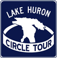
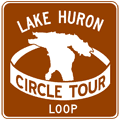
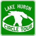 The Lake Huron Circle Tour (LHCT) traverses a 1,059-mile (1,704 km) route around the second-largest Great Lake through Michigan and Ontario. Those two jurisdictions roughly split the mainline route mileage of the LHCT—55% in Ontario and 45% in Michigan. A split-route configuration for the Lake Huron Circle Tour Loop in Ontario also traverses Manitoulin Island, utilizes the MS Chi-Cheemaun ferry between South Baymouth and Tobermory, and runs the length of the Bruce Peninsula. Michigan LHCT route markers use the standard white-on-green style, while Ontario opted for a white-on-blue style instead. Maintenance of LHCT route markers in Ontario has ceased and most have disappeared, while the route is still reasonably well signed in Michigan.
Lake Huron Circle Tour Route
Michigan
The Lake Huron Circle Tour (LHCT) enters the state from Ontario at Port Huron, traverses around the entirety of Michigan’s Thumb, around Saginaw Bay, then up the state’s east coast to the tip of the Lower Peninsula. There, it crosses the Mackinac Bridge and continues through the eastern Upper Peninsula to Sault Ste. Marie where it crosses the International Bridge and continues back into Ontario. In Michigan, the 481-mile (775 km) route follows the mainline state trunkline highway running closest to Lake Huron. The officially designated route for the LHCT is as follows:
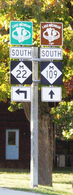
- The LHCT enters Michigan from Ontario via the Bluewater Bridge in Sarnia.
- The tour takes the first exit past US Customs and heads north out of Port Huron via M-25.
- The route continues on M-25 along the Lake Huron and Saginaw Bay shorelines taversing the entire Thumb between Port Huron and Bay City.
- At Bay City, the LHCT departs M-25 and turns northerly to follow M-13 toward Standish.
- When M-13 ends at US-23 south of Standish, the route continues northerly via US-23 parallel to the Saginaw Bay and Lake Huron shores through Tawas City, Oscoda, Alpena, Rogers City and Cheboygan.
- At the northern terminus of US-23 in Mackinaw City, the LHCT veers north to follow I-75 over the Mackinac Bridge and into the Upper Peninsula.
- At the north end of the Mackinac Bridge, the circle tour exits I-75 at Exit 344A and follows BL I-75 through downtown St Ignace.
- North of St Ignace, the LHCT re-joins I-75 at Exit 348 and continues northerly.
- The route leaves I-75 at Exit 359 and continues easterly along M-134 through Cedarville to M-48.
- At this point, a LHCT Loop Route continues easterly on M-134 into De Tour Village, then doubles back via North Caribou Lake Rd, terminating at M-48/LSCT a few miles north of the M-48 & M-134 junction.
- The mainline LHCT turns northerly from M-134 and continues northwesterly on M-48 through Goetzville to M-129.
- The route continues northerly on M-129 through Pickford and into Sault Ste Marie.
- In Sault Ste Marie, the circle tour turns westerly from the end of M-129 on BS I-75.
- At I-75 Exit 392, the route turns northerly to traverse the final three miles of I-75 and crosses the International Bridge into Sault Ste Marie, Ontario.
 Ontario
The LHCT enters the province from Ontario in the middle of the International Bridge spanning the St. Marys River dividing Sault Ste. Marie, Michigan and Sault Ste. Marie, Ontario. The 931 km (578-mile) route then travels along the highway closest to Lake Huron easterly to Sudbury, then southerly and westerly around the remainder of Georgian Bay to Owen Sound where it continues southerly along the Lake Huron shore to Sarnia and Port Edwards where the route continues into Michigan via the Blue Water Bridge. The 255 km (158-mile) LHCT “Georgian Bay Route” 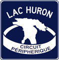 shaves 306 km (190 miles) from the route running via Manitoulin Island, then across the mouth of Georgian Bay via the MS Chi-Cheemaun ferry, then southerly down the Bruce Peninsula, although this route can only be fully traversed from May to October each year while the ferry is in service. To accommodate francophone tourists, Ontario also posted a companion LHCT route marker (see image at right) reading Lac Huron Circuit Périphérique. The designated route for the LHCT in Ontario is as follows:
- Enters from the Province of Ontario via the International Bridge in the City of Sault Ste. Marie in the District of Algoma.
- The route of the LSCT through downtown Sault Ste. Marie follows the former route of Hwy 17B, which features several turns. Hwy 17B in downtown Sault Ste. Marie was a pair of one-way routes, so each direction of the LHCT route is presented below:
- Eastbound (Clockwise): From the end of the International Bridge approach, the LHCT heads southerly for 1½ blocks via Huron St to Bay St.
- Southeasterly via Bay St from Huron St for approximately 10 blocks to Pim St.
- Northeasterly via Pim St for one block from Bay St to Queen St.
- Easterly for one block via Queen St from Pim St to Church St.
- Northerly again via Church St for two blocks from Queen St to the intersection of Church St & Wellington St where it rejoins the westbound LHCT route. (The LSCT departs the LHCT where Church St intersects Wellington St.)
- Westbound (Counterclockwise): From the intersection of Wellington St & Church St, the LHCT heads westerly and northwesterly via Wellington St for 14 blocks from Pim St to Cathcart St. (The LSCT joins the LHCT at the intersection of Pim St & Wellington St.)
- Westerly via Cathcart St for five blocks from Wellington St to Huron St.
- Southerly via Huron St for three blocks from Cathcart St to the International Bridge entrance, where it rejoins the northbound route.
- From the intersection of Wellington St & Church St in Sault Ste. Marie, the LHCT continues easterly via Wellington St to Trunk Rd.
- Northeasterly via Trunk Rd from Wellington St to junction Hwy 17/T/Black Rd.
- Northeasterly via Hwy 17/T /Trunk Rd from Black Rd to west junction of Hwy 17/T & Hwy 17B.
- Easterly, southeasterly and southerly via Hwy 17B from the west junction of Hwy 17/T & Hwy 17B trough Garden River and Echo Bay to south junction of Hwy 17/T & Hwy 17B.
- Southerly and easterly via Hwy 17/T from the south junction of Hwy 17/T & Hwy 17B through the communities of Thessalon, Blind River, Spanish and Massey to junction Hwy 17/T & Hwy 6 near McKerrow.
- LHCT Georgian Bay Route: Departs Hwy 17/T at junction Hwy 6 near McKerrow and rejoins at junction Bruce Rd 10 in Alvanley west of Owen Sound. (See description below.)
- Mainline LHCT continues easterly via Hwy 17/T from Hwy 6 at McKerrow to jct Hwy 69/T on the south side of the City of Greater Sudbury.
- Southerly via Hwy 69/T from Hwy 17 on the south side of Greater Sudbury to Hwy 559 at Exit 241 north of Nobel in Parry Sound District.
- Southerly via Hwy 400/Hwy 69/T from Hwy 559 at Exit 241 north of Nobel to Hwy 69/Rankin Lake Rd at Exit 213 southeast of Parry Sound.
- Southerly via Hwy 400/T from Hwy 69/Rankin Lake Rd at Exit 213 southeast of Parry Sound to Hwy 12/Simcoe Rd 16 at Exit 147 at Waubaushene.
- Westerly via Hwy 12 from Hwy 400/T at Exit 147 at Waubaushene to Hwy 93/Simcoe Rd 93/Penetanguishene Rd near Midland.
- Southerly via Hwy 93/Penetanguishene Rd from Hwy 12 near Midland to Simcoe Rds 27 & 23 at Waverley.
- Southwesterly than southeasterly via Simcoe Rd 27 from Hwy 93 at Waverley to Simcoe Rds 19 & 92 at Elmvale.
- Southwesterly via Simcoe Rd 92 from Simcoe Rd 27 at Elmvale to Hwy 26 at Brooks Beach on the western edge of the Town of Wasaga Beach.
- Northwesterly via Hwy 26 from Simcoe Rd 92 at Brooks Beach to the intersection of Hume St & Pretty River Pkwy in Collingwood.
- Northerly and northwesterly via Hwy 26/Pretty River Pkwy from Hume St to Huron St.
- Westerly via Hwy 26/Huron St and Hwy 26/First St from Pretty River Pkwy to intersection of First St, First St Extension, High St & Hwy 26/Balsam St.
- Northwesterly via Hwy 26 from intersection of First St, First St Extension, High St & Balsam St in Collingwood through Meaford, then westerly via Hwy 26 into Owen Sound to intersection of 16th St E & 9th Ave E.
- Southwesterly via Hwy 26/9th Ave E from 16th St E to junction Hwy 6/Hwy 10 & Hwy 21 at intersection of 9th Ave E & 10th St E.
- Westerly via Hwy 6/Hwy10/10th St E from junction Hwy 21/9th Ave E through downtown Owen Sound to the west junction of Hwy 6 & Hwy 21 west of the city.
- Westerly via Hwy 21 from the west junction of Hwy 6 & Hwy 21 west of Owen Sound to Bruce Rd 10 at Alvanley.
- LHCT Georgian Bay Route: Departs Hwy 21 at junction Bruce Rd 10 in Alvanley west of Owen Sound and rejoins at junction Hwy 6 near McKerrow. (See description below.)
- Westerly, southwesterly and southerly via Hwy 21 from Bruce Rd 10 at Alvanley through or past the communities of Port Elgin, Kincardine, Goderich, Grand Bend and Forest to Hwy 402 at Exit 34 near Warwick.
- Westerly via Hwy 402 from Hwy 21 at Exit 34 near Warwick to Sarnia and then into Michigan on the Blue Water Bridge at Port Edwards.
Lake Huron Circle Tour Loop Routes
 Lake Huron Circle Tour - Loop Route (De Tour Village)
A locally-designated loop route which helps circle tour motorists navigate into and through the off-route community of De Tour Village, the jumping-off point for the ferry to Drummond Island. As with all Loop Routes, this route is designated with white-on-brown circle tour signs, using the same LHCT "logo." The route:
- The LHCT Loop Route begins at the jct of M-134 & M-48 between Cedarville and De Tour Village and continues easterly on M-134 toward De Tour Village.
- The route enters De Tour Village on M-134, but continues northerly through the village when M-134 turns east toward the Drummond Island Ferry dock.
- On the north end of town, the loop route turns west and follows North Caribou Lake Rd.
- The loop route ends at M-48/LHCT a few miles north of the jct of M-134.
Lake Huron Circle Tour - Georgian Bay Route
When it was signed, the Georgian Bay Route was signed and shown on maps as a split-route, using the same signs as the mainline route, unlike the various Circle Tour Loops and Spurs elsewhere using white-on-brown route markers. This route measuring 255 km (158 miles) in length—including the 40 km (25 mile) ferry segment—is only fully traversable from May to October when the MS Chi-Cheemaun ferry is in operation.
- Departs LHCT mainline at junction of Hwy 17/T and Hwy 6 at McKerrow north of Espanola in the District of Subury.
- Southerly via Hwy 6 from Hwy 17/T at McKerrow through Espanola and onto Manitoulin Island to junction Hwy 540 in the centre of Little Current.
- Southerly across Manitoulin Island via Hwy 6 from junction Hwy 540 in Little Current via Manitowaning to the MS Chi-Cheemaun ferry dock in South Baymouth.
- Southeasterly across the mouth of Georgian Bay via the MS Chi-Cheemaun ferry from South Baymouth on Manitoulin Island to Tobermory at the tip of the Bruce Peninsula.
- Southeasterly and southerly via Hwy 6 from the MS Chi-Cheemaun ferry dock in Tobermory through Wiarton to junction Hwy 6 & Bruce Rd 10 in Hepworth.
- Southerly via Bruce Rd 10 from Hwy 6 in Hepworth to Hwy 21 at Alvanley.
- The “Georgian Bay Route” rejoins the LHCT mainline at Jct Bruce Rd 10 & Hwy 21 in Alvanley on the Grey/Bruce county line.
Back to: The Circle Tours.
Additional Information
- Lake Huron Circle Tour - listing from MichiganHighways.org.
- Great Lakes Circle Tour - information from the Great Lakes Commission. It was the GLC who originally established the Great Lakes Circle Tours and continues to provide information on many aspects of the Great Lakes region.
- Lake Huron Circle Tour - from the Great Lakes Information Network (GLIN), which "is a partnership that provides one place online for people to find information relating to the binational Great Lakes-St. Lawrence region of North America." Although, note the route description on this website is very vague and actually cuts off several portions of the route!