Lake Erie Circle Tour
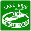 The 629-mile (1,012 km) Lake Erie Circle Tour (LECT) circles the second-smallest Great Lake, spanning four U.S. states and the Canadian province of Ontario in the process. The LECT is the most recent of the four designated Great Lakes Circle Tours, being signed in 1990. The portions of the route in New York and Pennsylvania share the route of the Great Lakes Seaway Trail and only a few LECT signs are posted in Pennsylvania while New York has never posted the route. The LECT route is currently not signed at all in Ontario as well.
Lake Erie Circle Tour Route
 Ontario
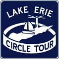
The Lake Erie Circle Tour (LECT) enters the province of Ontario via the Ambassador Bridge connecting Detroit and Windsor. It traverses the entirety of Southwestern Ontario from Windsor via Leamington, St. Thomas, Tillsonburg, Simcoe, and Port Colborne, to Fort Erie. The LECT uses the Peace Bridge to cross into New York state. In the period when the route was signed in the province, Ontario signed the route using white-on-blue route markers, different from the 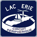 white-on-green signs used on the U.S. portions. To accommodate francophone tourists, Ontario also had a companion LECT route marker (see image at right) reading Lac Erie Circuit Périphérique. The 416 km (258-mile) Ontario route for the LECT is detailed below.
Note: Route signage for the Ontario segment of the Lake Erie Circle Tour is largely missing along much of the route in the province. This is due in part to the massive “downloading” of many formerly provincial highways. Additionally, the Ontario Ministry of Transportation has ceased signing most of their “Tourist Routes” with a few exceptions..
- Enters Ontario from the State of Michigan via the Ambassador Bridge spanning the Detroit River between Detroit, Michigan and Windsor, Ontario.
- From the end of the Ambassador Bridge approach, the LECT continues southerly via Hwy 3/Huron Church Rd to Todd Ln-Cabana Rd.
- Southeasterly via Hwy 3/Talbot Rd from Todd Ln-Cabana Rd to the beginning of Hwy 401.
- Southeasterly via Hwy 3/Talbot Rd from Hwy 401, bypassing Essex and Cottam to junction Hwy 77 & Essex Rd 33 on the north side of Leamington.
- Southeasterly via Essex Rd 33 from junction Hwy 3 & Hwy 77 to Essex Rd 34/Talbot Rd northeast of downtown Leamington.
- Northeasterly via Essex Rd 34/Talbot Rd from Essex Rd 33 to the Essex County/Chatham-Kent boundary on the west edge of Wheatley.
- Northeasterly via Chatham-Kent Rd 3/Talbot Trail from the Essex County/Chatham-Kent boundary through Wheatley into Blenheim via Chatham-Kent Rd 3/Talbot St to Chatham-Kent Rd 8/Marlborough St.
- Easterly via Chatham-Ken Rd 3/Marlborough St from Talbot St in downtown Blenheim to Chatham-Kent Rd 11/Chatham St.
- Southeasterly via Chatham-Kent Rd 3/Chatham St from Chatham-Kent Rd 11 in Blenheim to Chatham-Kent Rd 11/Communication Rd.
- Northeasterly via Chatham-Kent Rd 3/Talbot Trail from Chatham-Kent Rd 11/Communication Rd through Morpeth and Wallacetown to junction Hwy 3, Hwy 4 & Middlesex Rd 4 at Talbotville.
- Easterly via Hwy 3/Talbot Line from junction Hwy 4, Middlesex Rd 3 & Middlesex Rd 4 at Talbotville to Middlesex Rd 25/Wellington Rd.
- Southeasterly and easterly via Hwy 3/St. Thomas Expwy from Middlesex Rd 25/Wellington Rd through St. Thomas to Centennial Ave.
- Southerly via Hwy 3/Centennial Ave from the St. Thomas Expwy to Talbot St-Talbot Line.
- Easterly via Hwy 3/Talbot Line through Aylmer and Tillsonburg to the intersection of Talbot Rd, Mill St & King St in Delhi.
- Southeasterly via Hwy 3/King St from Talbot Rd & King St through downtown Delhi to Haldimand Rd 37/Swimming Pool Rd.
- Southerly via Hwy 3/James St from King St & Swimming Pool Rd to Haldimand Rd 44/Pine Grove Rd.
- Easterly via Hwy 3 from Haldimand Rd 44/Pine Grove Rd through Simcoe (where it is also named Queensway), Jarvis (where it is also named Talbot St), and Cayuga (where it is also named Talbot St) to Dunnville Rd & Norfolk Rd 14/Smithville Rd at Canborough.
- Southerly and southeasterly via Hwy 3/Dunnville Rd from Canborough to Norfolk Rd 15/Robinson Rd on the western edge of Dunnville.
- Easterly via Hwy 3/Main St W from Norfolk Rd 15/Robinson Rd into Dunnville to George St.
- Northerly via Hwy 3/George St for two blocks from Main St W to Broad St W in Dunnville.
- Easterly via Hwy 3/Broad St from George St through Dunnville to the eastern edge of Dunnville.
- Northeasterly and easterly via Hwy 3 from Dunnville to intersection of Niagara Rd 23/Forks Rd & Niagara Rd 24/Vineland Townline Rd at Chambers Corners.
- Southerly via Hwy 3 from Chambers Corners through Wainfleet to Niagara Rd 3/Concession Rd 1 near Ostryhon Corners.
- Easterly via Hwy 3 from Niagara Rd 3/Concession Rd 1 to the western limit of the City of Port Colborne at Port Colborne Wainfleet Townline Rd.
- Easterly via Niagara Rd 3/Main St from Port Colborne Wainfleet Townline Rd through Port Colborne to junction Niagara Rd 3, Hwy 3 & Hwy 140 northeast of downtown Port Colborne.
- Easterly via Hwy 3 from junction Niagara Rd 3, Hwy 3 & Hwy 140 northeast of downtown Port Colborne to Rose Hill Rd in the Town of Fort Erie.
- Easterly via Niagara Rd 3/Garrison Rd in Fort Erie from Rose Hill Rd to Niagara Rd 122/Thompson Rd.
- Northerly via Niagara Rd 122/Thompson Rd from Niagara Rd 3/Garrison Rd to the QEW (Queen Elizabeth Way) at Exit 2.
- Easterly via the QEW from Niagara Rd 122/Thompson Rd at Exit 2 to the Fort Erie Terminus of the QEW at the Peace Bridge Plaza.
- Easterly via the Peace Bridge into the State of New York and the City of Buffalo.
New York State
 The Lake Erie Circle Tour (LECT) enters the state of New York via the Peace Bridge connecting Fort Erie, Ontario and Buffalo, New York. In downtown Buffalo, the LECT picks up the route of the Great Lakes Seaway Trail and follows it along the southern shore of Lake Erie and into Pennsylvania. New York State does not post route markers for its 74.7 miles (120.2 km) of the LECT at all, rather those following the route must first find the Great Lakes Seaway Trail (GLST) and then follow the markers for that route. Additionally, the Seaway Trail was retitled the Great Lakes Seaway Trail in 2010 and new route markers are being installed along the route. The New York route for the LECT is as follows:
- Enters New York from the Province of Ontario via the Peace Bridge spanning the Niagara River between Fort Erie, Ontario and Buffalo, New York.
- The LECT somehow makes its way to the Great Lakes Seaway Trail (GLST) from the Peace Bridge, possibly southeasterly via Baird Dr to Porter Ave, then northeasterly via Porter Ave from Baird Dr to SR-266/Niagara St.
- Southeasterly via SR-266/Niagara St from Porter Ave toward downtown Buffalo to the I-196/Niagara Thruway ramps (at Exit 8), halfway between Virginia and Carolina Sts where SR-266 terminates.
- Southeasterly via Niagara St from the I-190/Niagara Thruway ramps to Niagara Square, where the GLST takes two different routes depending on direction of travel:
- Southbound (clockwise): Counterclockwise around Niagara Square (SR-384) from Niagara St to the second right at SR-384/Delaware Ave. Southerly via SR-384/Delaware Ave for two blocks to SR-5/Church St. Westerly for 2½ blocks via to SR-5 west/Church St, then southeasterly via the ramp to I-190/Niagara Thruway south and SR-5 west, then southerly via Exit 5 for SR-5 west toward Lackawana. The GLST then proceeds southerly via SR-5 along the Buffalo Skyway.
- Northbound (counterclockwise): At the northern end of the Buffalo Skyway at the intersection of Delaware Ave & Church St in downtown Buffalo, the GLST continues straight ahead via SR-384/Delaware Ave for two blocks from Church St to Niagara Square. There, the route continues counterclockwise around the square to the fifth right at Niagara St, where it continues northwesterly toward Elmwood Ave.
- Southerly via SR-5/Buffalo Skyway from I-190/Niagara Thruway in downtown Buffalo, then continuing southerly via SR-5 through Lackawana and Woodlawn to junction SR-75 near Athol Springs.
- Southwesterly via SR-5/Lake Shore Rd from SR-75 near Athol Springs to the intersection of Old Lake Shore Rd at Clifton Heights.
- Southwesterly via Old Lake Shore Rd from SR-5/Lake Shore Rd at Clifton Heights through Pinehurst to the intersection of Lake Shore Rd & Dennis Rd in the Town of Evans.
- Westerly, southerly and southwesterly via Lake Shore Rd from Dennis Rd in the Town of Evans through Angola on the Lake, Lake Erie Beach and Evangola State Park before looping back to the east and northeasterly to SR-5/Erie Rd between Farnham and Irving.
- Southeasterly via SR-5/Erie Rd from Old Lake Shore Rd between Farnham and Irving to junction US-20/Southwestern Blvd & SR-438/4 Mile Level Rd just east of Irving.
- Southwesterly via US-20/SR-5/Main Rd from junction US-20, SR-5 & SR-438 past Irving and Sunset Bay to the intersection of Central Ave & Howard St just east of Silver Creek.
- Northwesterly, westerly and southwesterly via SR-5/TRUCK US-20/Howard St from US-20/Central Ave to the intersection of Howard St & Central Ave in downtown Silver Creek.
- Southwesterly via SR-5 from Silver Creek through the communities of Dunkirk and Barcelona to the Pennsylvania state line in the Town of Ripley.
Pennsylvania
 Pennsylvania’s 46.7 miles (75 km) of the Great Lakes Seaway Trail (GLST) is the shortest of the Lake Erie Circle Tour-related segments. It runs from the New York state line northeast of the Borough of North East, Pennsylvania, through Erie, past Fairview and Lake City, then into Ohio southwest of Girard. Very few LECT route markers are posted in Pennsylvania, rather the Seaway Trail—retitled the Great Lakes Seaway Trail (GLST) in 2010—is reasonably well posted along the route. The Pennsylvania route for the LECT is as follows:
- Enters Pennsylvania from the State of New York via SR-5 in North East Twp, northeast of the Borough of North East.
- Southwesterly via SR-5/Lake Rd from the New York state line into the City of Erie to junction SR-5 & ALT SR-5 at the intersection of Lake Rd & Franklin Ave.
- Westerly via ALT SR-5/Lake Rd from SR-5/Franklin Ave to East Ave, then continuing westerly via ALT SR-5/E 6th St from East Ave to intersection of E 6th St & Bayfront Pkwy.
- Northerly via Bayfront Pkwy from ALT SR-5/E 6th St to the intersection of Bayfront Pkwy, E Bay Dr & Port Access Rd.
- Westerly via Bayfront Pkwy from the intersection of E Bay Dr & Port Access Rd past downtown Erie to the intersection of Bayfront Pkwy & Cranberry St.
- Southerly via Cranberry St from Bayfront Pkwy for two blocks to ALT SR-5/W 6th St.
- Westerly via ALT SR-5/W 6th St from Cranberry St to Cherokee Dr.
- Southwesterly via ALT SR-5/Cherokee Dr for two blocks from W 6th St to Seminole Dr.
- Southerly via ALT SR-5/Seminole Dr from Cherokee Dr to W 8th St.
- Westerly via ALT SR-5/W 8th St from Seminole Dr to SR-832/Peninsula Dr.
- Westerly via ALT SR-5/W Lake Rd from SR-832/Peninsula Dr to junction SR-5 at the intersection of W Lake Rd, W 12th St & Ashbury Rd.
- Southwesterly via SR-5/Lake Rd from junction ALT SR-5 through Avonia, Lake City and North Springfield to US-20/Ridge Rd southwest of Girard.
- Westerly via US-20/Ridge Rd from SR-5/Lake Rd into the State of Ohio in Erie County’s Springfield Twp.
Ohio
DESCRIPTION AND ROUTE IN DEVELOPMENT
Length in Ohio: 200 miles (322 km)
Michigan
The Lake Erie Circle Tour (LECT) enters the state from Ohio in southeastern Monroe Co. It parallels the Lake Erie shoreline through Monroe and the Downriver Detroit area and into the City of Detroit. There, the LECT uses the Ambassador Bridge to cross into Ontario at Windsor. The 49.2-mile (79.3 km) designated route for the LECT is as follows:
- The LECT enters Michigan from Ohio on I-75 south of Erie and proceeds northerly toward Monroe and Detroit on I-75.
- Just inside Wayne Co, the circle tour leaves I-75 at Exit 28 and follows M-85/Fort Rd through Trenton, Riverview, Lincoln Park and into Detroit.
- The route re-joins I-75 at Exit 43 in southwestern Detroit and continues northeasterly.
- The LECT leaves I-75 at the Ambassador Bridge and crosses into Windsor, Ontario.
Back to: The Circle Tours.
Additional Information
- Lake Erie Circle Tour - listing from MichiganHighways.org.
- Great Lakes Circle Tour - information from the Great Lakes Commission. It was the GLC who originally established the Great Lakes Circle Tours and continues to provide information on many aspects of the Great Lakes region.
- Lake Erie Circle Tour - from the Great Lakes Information Network (GLIN), which "is a partnership that provides one place online for people to find information relating to the binational Great Lakes-St. Lawrence region of North America."
- Ohio's Lake Erie Circle Tour - a tourist-oriented website from the Lake Erie Improvement Association promoting attractions along the Buckeye State's portion of the LECT.
- Lake Erie Journal: Guide to the Official Lake Erie Circle Tour - a website about this book authored by Scott Carpenter.

